Map of Spain by autonomous community
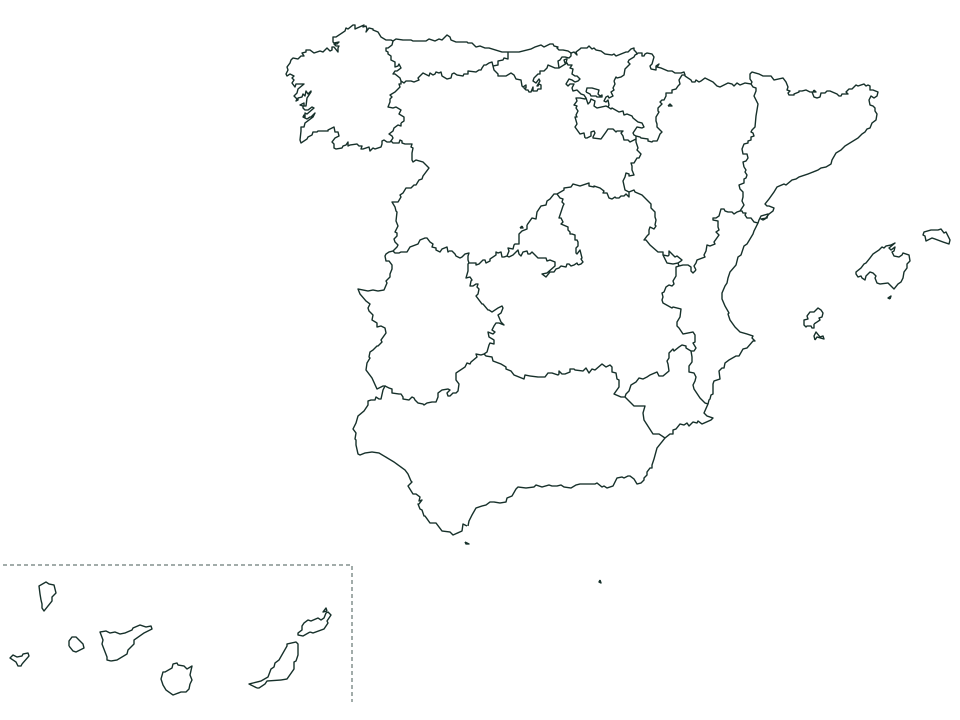
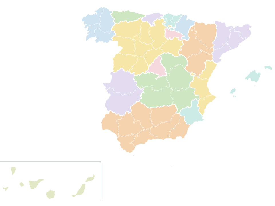
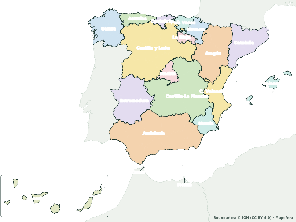
Spain’s 17 autonomous communities (its regions) plus the autonomous cities of Ceuta and Melilla. Tap a community to see its provinces, its seat of government and its area, and download the map free to print.
Map of Spain by autonomous community
Spain’s 17 autonomous communities and the autonomous cities of Ceuta and Melilla. The Canary Islands, in the inset.
Map colors
- Andalucía
- Aragón
- Principado de Asturias
- Islas Baleares
- Canarias
- Cantabria
- Castilla y León
- Castilla-La Mancha
- Cataluña
- Comunidad Valenciana
- Extremadura
- Galicia
- Comunidad de Madrid
- Región de Murcia
- Navarra
- País Vasco
- La Rioja
- Ceuta
- Melilla
Map colors
- Andalucía
- Aragón
- Principado de Asturias
- Islas Baleares
- Canarias
- Cantabria
- Castilla y León
- Castilla-La Mancha
- Cataluña
- Comunidad Valenciana
- Extremadura
- Galicia
- Comunidad de Madrid
- Región de Murcia
- Navarra
- País Vasco
- La Rioja
- Ceuta
- Melilla
Boundaries: © IGN (CC BY 4.0) · Map by Mapsfera · mapsfera.pages.dev/maps/spain-communities/
The 17 communities, from largest to smallest
Each in its map color, with its seat of government and its provinces. The bar compares its area with Castilla y León, the largest.
- 1
Castilla y León (Castile and León)
94,081 km²- Seat of government
- Valladolid
- 9 provinces
- Ávila, Burgos, León, Palencia, Salamanca, Segovia, Soria, Valladolid, and Zamora
- Share of Spain
- 18.6%
- 2
Andalucía (Andalusia)
87,596 km²- Seat of government
- Sevilla
- 8 provinces
- Almería, Cádiz, Córdoba, Granada, Huelva, Jaén, Málaga, and Sevilla
- Share of Spain
- 17.3%
- 3
Castilla-La Mancha (Castilla–La Mancha)
79,370 km²- Seat of government
- Toledo
- 5 provinces
- Albacete, Ciudad Real, Cuenca, Guadalajara, and Toledo
- Share of Spain
- 15.7%
- 4
Aragón (Aragon)
47,673 km²- Seat of government
- Zaragoza
- 3 provinces
- Huesca, Teruel, and Zaragoza
- Share of Spain
- 9.4%
- 5
Extremadura
41,598 km²- Seat of government
- Mérida
- 2 provinces
- Badajoz and Cáceres
- Share of Spain
- 8.2%
- 6
Cataluña (Catalonia)
32,074 km²- Seat of government
- Barcelona
- 4 provinces
- Barcelona, Girona, Lleida, and Tarragona
- Share of Spain
- 6.3%
- Official name
- Cataluña/Catalunya
- 7
Galicia
29,545 km²- Seat of government
- Santiago de Compostela
- 4 provinces
- A Coruña, Lugo, Ourense, and Pontevedra
- Share of Spain
- 5.8%
- 8
Comunidad Valenciana (Valencian Community)
23,248 km²- Seat of government
- Valencia
- 3 provinces
- Alicante, Castellón, and Valencia
- Share of Spain
- 4.6%
- Official name
- Comunitat Valenciana
- 9
Región de Murcia (Region of Murcia)
11,312 km²- Seat of government
- Murcia
- Province
- Murcia
- Share of Spain
- 2.2%
- 10
Principado de Asturias (Asturias)
10,586 km²- Seat of government
- Oviedo
- Province
- Asturias
- Share of Spain
- 2.1%
- 12
- Seat of government
- Madrid
- Province
- Madrid
- Share of Spain
- 1.6%
- 13
Canarias (Canary Islands)
7,462 km²- Seats of government
- Santa Cruz de Tenerife and Las Palmas de Gran Canaria
- 2 provinces
- Las Palmas and Santa Cruz de Tenerife
- Share of Spain
- 1.5%
- 14
País Vasco (Basque Country)
7,223 km²- Seat of government
- Vitoria-Gasteiz
- 3 provinces
- Álava, Bizkaia, and Gipuzkoa
- Share of Spain
- 1.4%
- Official name
- País Vasco/Euskadi
- 15
- 16
- 17
Islas Baleares (Balearic Islands)
4,987 km²- Seat of government
- Palma
- Province
- Baleares
- Share of Spain
- 1.0%
- Official name
- Illes Balears
Autonomous cities
In North Africa. They belong to no community.
Want to see the provinces and their capitals too? See the map of Spain by province.
For the classroom
Free, no sign-up, and ready to print on Letter or A4.
Frequently asked questions
What people most often ask about Spain’s 17 autonomous communities.
Source of the boundaries and areas: IGN, Spain’s national mapping agency (CC BY 4.0). Methodology and sources
How many autonomous communities does Spain have?
17. There are also the autonomous cities of Ceuta and Melilla, in North Africa, which belong to no community.
What is the largest autonomous community?
Castilla y León (Castile and León), at 94,081 km²: 18.6% of Spain. Next come Andalucía (Andalusia) (87,596 km²) and Castilla-La Mancha (Castilla–La Mancha) (79,370 km²).
And the smallest?
Islas Baleares (Balearic Islands), at 4,987 km², followed by La Rioja (5,038 km²) and Cantabria (5,321 km²). Ceuta (20 km²) and Melilla (14 km²) are much smaller, but they are autonomous cities.
What is the capital of each community?
The seat of its government, shown in the list above. It’s almost always a provincial capital; the exceptions are Mérida (Extremadura) and Santiago de Compostela (Galicia). Canarias has two: Santa Cruz de Tenerife and Las Palmas de Gran Canaria.
How many provinces does each community have?
Castilla y León: 9; Andalucía: 8; Castilla-La Mancha: 5; Cataluña and Galicia: 4; Aragón, Comunidad Valenciana, and País Vasco: 3; Canarias and Extremadura: 2; and the other 7 have one each. Castilla y León has the most.
What’s the difference between a community and an autonomous city?
Ceuta and Melilla are autonomous cities: they have their own statute of autonomy, but belong to no community or province, and their assemblies don’t pass laws the way regional parliaments do.
Can I download the map for class?
Yes, free and with no sign-up: as PDF, PNG or SVG, in any of its four views (labeled, with provinces, with capitals or blank). The boundaries come from Spain’s national mapping agency (IGN, CC BY 4.0): if you publish it, credit “Boundaries: © IGN”.