Blank map of Navarre by municipality
The 272 municipalities of Navarre (Navarra), with their borders, ready to print on A4, Letter, A3 or Tabloid. Free, no sign-up.
Preview · A4 portrait · Blank
Set up your sheet
Version
Paper size
Orientation
Title on the sheet
The PDF comes out at actual size, with margins so nothing gets cut off. In the print window, choose “Save as PDF”. Letter and Tabloid are US paper sizes; A4 and A3, the rest of the world’s.
For class · PDF
Worksheet with questions and an answer key
One page with the map and the questions, and another with the answers.
Make the worksheetLicense
Free for class and personal use
Print it, copy it and hand it out. If you publish it, credit it like this. For other uses, get in touch.
Mapsfera · data IGN (CC BY 4.0)
Navarre in numbers
Navarre is an autonomous community with a single province. It has 272 municipalities, covers 10,392 km² and is home to 683,500 people, according to Spain’s 2025 municipal register (INE). Its capital is Pamplona.
The map also has 16 pieces of land that belong to several municipalities at once (condominiums): Facero de Uzamalarre, Facería de Arambelza, Mancomunidad de Beunza y Juarbe, and Comunidad de Barbarín y Olejúa and others. They are drawn but not counted as municipalities.
The largest municipality is Baztan (371 km²) and the smallest, Villava/Atarrabia (1.06 km²). Castillonuevo/Gazteluberri has the fewest people, 14, and half of the municipalities have 375 or fewer. These are the ten largest by population:
| Municipality | Population | Area |
|---|---|---|
| Pamplona/Iruña | 209,094 | 25 km² |
| Tudela | 38,903 | 215 km² |
| Valle de Egüés/Eguesibar | 22,825 | 53 km² |
| Burlada/Burlata | 21,280 | 2 km² |
| Barañáin/Barañain | 19,642 | 1 km² |
| Zizur Mayor/Zizur Nagusia | 16,510 | 5 km² |
| Estella-Lizarra | 14,317 | 15 km² |
| Aranguren | 13,216 | 41 km² |
| Berriozar | 11,361 | 3 km² |
| Tafalla | 10,854 | 98 km² |
Number key (107)
- 1 Abaurregaina/Abaurrea Alta
- 2 Ablitas
- 3 Aibar/Oibar
- 4 Allín/Allin
- 5 Altsasu/Alsasua
- 6 Améscoa Baja
- 7 Andosilla
- 8 Anue
- 9 Añorbe
- 10 Araitz
- 11 Arakil
- 12 Arantza
- 13 Arce/Artzi
- 14 Arguedas
- 15 Arróniz
- 16 Artajona
- 17 Atetz
- 18 Auritz/Burguete
- 19 Basaburua
- 20 Baztan
- 21 Beintza-Labaien
- 22 Bera
- 23 Bertizarana
- 24 Buñuel
- 25 Burgui/Burgi
- 26 Cabanillas
- 27 Caparroso
- 28 Carcastillo
- 29 Cascante
- 30 Castillonuevo/Gazteluberri
- 31 Cendea de Olza/Oltza Zendea
- 32 Cintruénigo
- 33 Cirauqui/Zirauki
- 34 Cizur
- 35 Corella
- 36 Dicastillo
- 37 Erro
- 38 Esteribar
- 39 Etxalar
- 40 Etxarri Aranatz
- 41 Ezcabarte
- 42 Ezprogui
- 43 Falces
- 44 Fitero
- 45 Funes
- 46 Fustiñana
- 47 Gallipienzo/Galipentzu
- 48 Gallués/Galoze
- 49 Garde
- 50 Goizueta
- 51 Guesálaz/Gesalatz
- 52 Ibargoiti
- 53 Igúzquiza
- 54 Isaba/Izaba
- 55 Iza/Itza
- 56 Izagaondoa
- 57 Javier
- 58 Lana
- 59 Lapoblación
- 60 Larraga
- 61 Larraun
- 62 Leitza
- 63 Leoz/Leotz
- 64 Lerga
- 65 Lerín
- 66 Lesaka
- 67 Lizoain-Arriasgoiti/Lizoainibar-Arriasgoiti
- 68 Lodosa
- 69 Lónguida/Longida
- 70 Los Arcos
- 71 Luzaide/Valcarlos
- 72 Mélida
- 73 Mendavia
- 74 Milagro
- 75 Miranda de Arga
- 76 Murillo el Fruto
- 77 Navascués/Nabaskoze
- 78 Ochagavía/Otsagabia
- 79 Olite/Erriberri
- 80 Orbaizeta
- 81 Oteiza
- 82 Pamplona/Iruña
- 83 Peralta/Azkoien
- 84 Petilla de Aragón
- 85 Pitillas
- 86 Romanzado/Erromantzatua
- 87 Roncal/Erronkari
- 88 San Martín de Unx
- 89 Sangüesa/Zangoza
- 90 Sesma
- 91 Tafalla
- 92 Torralba del Río
- 93 Tudela
- 94 Uharte Arakil
- 95 Ujué/Uxue
- 96 Ultzama
- 97 Unciti
- 98 Unzué/Untzue
- 99 Urraul Alto
- 100 Uztárroz/Uztarroze
- 101 Valle de Egüés/Eguesibar
- 102 Valle de Elorz/Elortzibar
- 103 Valle de Ollo/Ollaran
- 104 Valle de Yerri/Deierri
- 105 Valtierra
- 106 Viana
- 107 Villatuerta
More blank maps
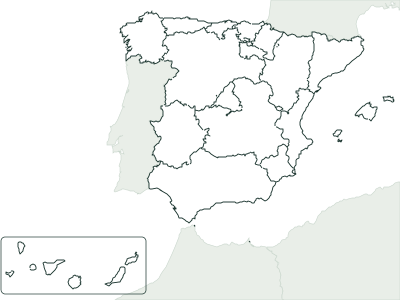
All blank maps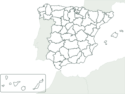
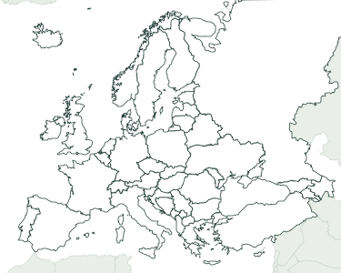
Frequently asked questions
How many municipalities does Navarre have?
272, all in the province of Navarra. The map also shows 16 shared areas.
What is the largest municipality in Navarre?
By area, Baztan, at 371 km². By population, Pamplona/Iruña, with 209,094 people in 2025, followed by Tudela (38,903).
Can I use it in class?
Yes, it’s free. Print it, copy it and hand it out as many times as you like. If you post it on a blog or a class website, credit “Mapsfera · data IGN (CC BY 4.0)”.
How do I print it on US Letter paper?
Choose Letter in “Paper size” and click “Download PDF”. In the print window, pick Letter paper and 100% scale (“Actual size”). For a bigger map, choose Tabloid (11 × 17 in) or A3.
What order are the numbers in?
Alphabetical, from 1 to the last one. That makes the key easy to follow when you grade, and it’s the same key the worksheet’s answer page uses.
Sources
- Municipal boundaries: Instituto Geográfico Nacional (IGN), BDDAE, CC BY 4.0
- Population: INE, official municipal register figures as of January 1, 2025
- Municipal areas: IGN, Nomenclátor Geográfico de Municipios y Entidades de Población (CC BY 4.0)