Blank map of Spain’s rivers
The 35 main rivers of Spain, ready to print on A4, Letter, A3 or Tabloid, or to download as PNG and SVG: blank, numbered or labeled. Free, no sign-up.
By the Mapsfera Team
Preview · A4 portrait · Numbered
Set up your sheet
Version
Paper size
Orientation
Title on the sheet
The PDF comes out at actual size, with margins so nothing gets cut off. In the print window, choose “Save as PDF”. Letter and Tabloid are US paper sizes; A4 and A3, the rest of the world’s.
License
Free for class and personal use
Print it, copy it and hand it out. If you publish it, credit it like this. For other uses, get in touch.
Mapsfera · data IGN (CC BY 4.0)
The rivers
The map shows 35 rivers: the 8 that Spain’s national mapping agency (IGN) ranks as first-order (Minho, Douro, Tagus, Guadiana, Guadalquivir, Ebro, Júcar, and Segura) plus the tributaries and coastal rivers taught in school. The longest is the Tagus, at 1,113 km / 691 mi (867 km in Spain), and the longest that runs entirely through Spain is the Ebro, at 953 km / 592 mi.
By the sea they flow into, they fall into three drainage slopes: 4 Cantabrian, 18 Atlantic and 13 Mediterranean. Cantabrian rivers are short, since they rise in the mountains close to the coast; Atlantic ones, the longest, cross the central plateau westward; and the Ebro dominates the Mediterranean side.
The Tagus has the most tributaries on the map: Jarama, Alberche, Tiétar, and Alagón.
How the map is made
River courses come from the IGN’s reference hydrography (IGR Hidrografía); the Portuguese stretches of the Douro, Tagus and Guadiana, from Natural Earth. Lengths are those in the IGN’s table of main rivers: the total, including the part in Portugal, and the Spanish part (national and border stretches).
Number key
Numbers follow alphabetical order. Each length is from that river’s source.
| No. | River | Length | In Spain | Flows into |
|---|---|---|---|---|
| 1 | Alagón | 212 km / 132 mi | 212 km | the Tagus (right bank) |
| 2 | Alberche | 197 km / 122 mi | 197 km | the Tagus (right bank) |
| 3 | Aragón | 210 km / 131 mi | 210 km | the Ebro (left bank) |
| 4 | Bidasoa | 47 km / 29 mi | 47 km | the Cantabrian Sea |
| 5 | Cabriel | 290 km / 180 mi | 290 km | the Júcar (left bank) |
| 6 | Cinca | 193 km / 120 mi | 193 km | the Segre (right bank) |
| 7 | Douro | 947 km / 589 mi | 732 km | the Atlantic Ocean |
| 8 | Ebro | 953 km / 592 mi | 953 km | the Mediterranean Sea |
| 9 | Esla | 289 km / 180 mi | 289 km | the Douro (right bank) |
| 10 | Gállego | 208 km / 129 mi | 208 km | the Ebro (left bank) |
| 11 | Genil | 346 km / 215 mi | 346 km | the Guadalquivir (left bank) |
| 12 | Guadalete | 180 km / 112 mi | 180 km | the Atlantic Ocean |
| 13 | Guadalhorce | 169 km / 105 mi | 169 km | the Mediterranean Sea |
| 14 | Guadalquivir | 655 km / 407 mi | 655 km | the Atlantic Ocean |
| 15 | Guadiana | 856 km / 532 mi | 712 km | the Atlantic Ocean |
| 16 | Jalón | 246 km / 153 mi | 246 km | the Ebro (right bank) |
| 17 | Jarama | 210 km / 130 mi | 210 km | the Tagus (right bank) |
| 18 | Júcar | 519 km / 323 mi | 519 km | the Mediterranean Sea |
| 19 | Llobregat | 168 km / 104 mi | 168 km | the Mediterranean Sea |
| 20 | Minho | 323 km / 201 mi | 323 km | the Atlantic Ocean |
| 21 | Nalón | 143 km / 89 mi | 143 km | the Cantabrian Sea |
| 22 | Navia | 160 km / 100 mi | 160 km | the Cantabrian Sea |
| 23 | Nervión | 84 km / 52 mi | 84 km | the Cantabrian Sea |
| 24 | Odiel | 134 km / 83 mi | 134 km | the Atlantic Ocean |
| 25 | Pisuerga | 289 km / 180 mi | 289 km | the Douro (right bank) |
| 26 | Segre | 276 km / 171 mi | 276 km | the Ebro (left bank) |
| 27 | Segura | 331 km / 205 mi | 331 km | the Mediterranean Sea |
| 28 | Sil | 239 km / 149 mi | 239 km | the Minho (left bank) |
| 29 | Tagus | 1,113 km / 691 mi | 867 km | the Atlantic Ocean |
| 30 | Ter | 217 km / 135 mi | 217 km | the Mediterranean Sea |
| 31 | Tiétar | 179 km / 111 mi | 179 km | the Tagus (right bank) |
| 32 | Tinto | 100 km / 62 mi | 100 km | the Odiel (left bank) |
| 33 | Tormes | 251 km / 156 mi | 251 km | the Douro (left bank) |
| 34 | Turia | 301 km / 187 mi | 301 km | the Mediterranean Sea |
| 35 | Zújar | 217 km / 135 mi | 217 km | the Guadiana (left bank) |
More blank maps
All blank maps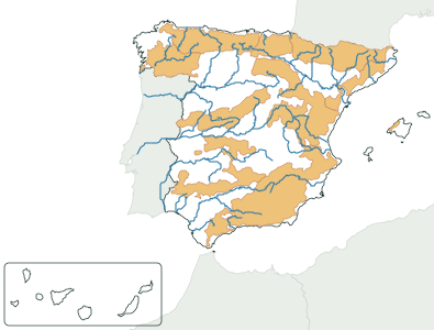
Frequently asked questions
What is the longest river in Spain?
The Tagus, at 1,113 km / 691 mi according to the IGN, of which 867 km run through Spain (or along its border) and the rest through Portugal. The longest that runs entirely through Spain is the Ebro, at 953 km / 592 mi.
Which rivers flow into the Mediterranean?
Of the main rivers, the Ebro, Ter, Llobregat, Turia, Júcar, Segura, and Guadalhorce; the other Mediterranean-side rivers on the map are their tributaries.
Can I use it in class?
Yes, it’s free. Print it, copy it and hand it out as many times as you like. If you post it on a blog or a class website, credit “Mapsfera · data IGN (CC BY 4.0)”.
What order are the numbers and letters in?
Alphabetical: rivers get numbers and mountain ranges get letters. The key is in the tables on this page.
Sources
- Rivers and lengths: IGN, Información Geográfica Destacada, “Principales ríos” (IGN_INFOGEO_RIOS, revised 2025-12-18), CC BY 4.0 ign.es
- River courses: IGN reference hydrography (IGR Hidrografía, IDEE download service), CC BY 4.0 scne.es; in Portugal, Natural Earth (public domain)
- Coast and borders: IGN (BDDAE, CC BY 4.0); neighboring countries, Natural Earth (public domain)