Blank map of Missouri by county
All 115 counties of Missouri, ready to print on Letter, Tabloid, A4 or A3, or to download as PNG and SVG. Free, no sign-up.
Preview · A4 portrait · Blank
Set up your sheet
Version
Paper size
Orientation
Title on the sheet
The PDF comes out at actual size, with margins so nothing gets cut off. In the print window, choose “Save as PDF”. Letter and Tabloid are US paper sizes; A4 and A3, the rest of the world’s.
License
Free for class and personal use
Print it, copy it and hand it out. If you publish it, credit it like this. For other uses, get in touch.
Mapsfera · data US Census Bureau
Missouri on the map
Missouri has 114 counties and St. Louis City, the 5th most of any state. The largest is Texas, with 1,177 sq mi of land, and the smallest is St. Louis (city), with 62 sq mi: Texas is about 19 times bigger.
The state capital, Jefferson City, is in Cole County, home to 99% of its residents; the city also reaches into Callaway County. The capital version marks it on the map.
St. Louis County is the most populous, with 990,911 people in 2025, or 16% of the state. The least populous is Worth, with 1,914. Since 2020, Lincoln has grown the fastest (+11.9%) and DeKalb has lost the most (−11.2%).
St. Louis City is an independent city: it belongs to no county, and the Census counts it as a county equivalent.
What each county borders
Texas borders the most counties in the state: 8 (Dent, Douglas, Howell, Laclede, Phelps, Pulaski, Shannon, and Wright).
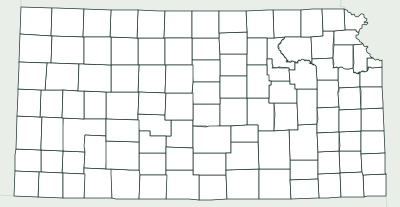
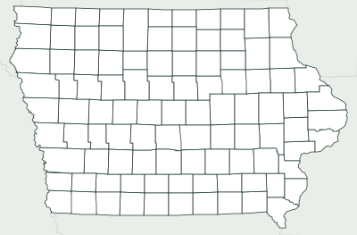
47 counties touch another state. 15 border Illinois: Cape Girardeau, Clark, Jefferson, Lewis, Lincoln, Marion, Mississippi, Perry and 7 more. 12 border Kansas: Andrew, Barton, Bates, Buchanan, Cass, Clay, Holt, Jackson and 4 more. 11 border Arkansas: Barry, Butler, Dunklin, Howell, McDonald, Oregon, Ozark, Pemiscot and 3 more. 9 border Iowa: Atchison, Clark, Harrison, Mercer, Nodaway, Putnam, Schuyler, Scotland and 1 more. 2 border Nebraska: Atchison and Holt. 2 border Oklahoma: McDonald and Newton.
None has a coastline: Missouri is landlocked.
Number key
Numbers follow alphabetical order, from 1 (Adair) to 115 (Wright). St. Louis (city) is too small for a number on Letter or A4 but keeps its number in the table; Tabloid and A3 fit more. Area is land area, without lakes or sea, and population is the Census estimate for July 1, 2025; “Borders” counts neighboring counties in the same state.
Show the whole table (115 rows)
| No. | County | Land area | Population (2025) | Borders |
|---|---|---|---|---|
| 1 | Adair | 567 sq mi | 25,684 | 7 |
| 2 | Andrew | 433 sq mi | 18,241 | 5 |
| 3 | Atchison | 547 sq mi | 5,175 | 2 |
| 4 | Audrain | 692 sq mi | 24,528 | 7 |
| 5 | Barry | 778 sq mi | 36,200 | 4 |
| 6 | Barton | 592 sq mi | 11,795 | 4 |
| 7 | Bates | 837 sq mi | 16,512 | 4 |
| 8 | Benton | 704 sq mi | 20,536 | 6 |
| 9 | Bollinger | 618 sq mi | 10,646 | 5 |
| 10 | Boone | 686 sq mi | 191,746 | 7 |
| 11 | Buchanan | 408 sq mi | 83,540 | 4 |
| 12 | Butler | 695 sq mi | 41,904 | 5 |
| 13 | Caldwell | 426 sq mi | 9,012 | 6 |
| 14 | Callaway | 835 sq mi | 45,765 | 5 |
| 15 | Camden | 656 sq mi | 44,047 | 7 |
| 16 | Cape Girardeau | 579 sq mi | 83,999 | 4 |
| 17 | Carroll | 695 sq mi | 8,417 | 6 |
| 18 | Carter | 507 sq mi | 5,418 | 6 |
| 19 | Cass | 697 sq mi | 115,859 | 4 |
| 20 | Cedar | 474 sq mi | 14,888 | 5 |
| 21 | Chariton | 751 sq mi | 7,377 | 7 |
| 22 | Christian | 563 sq mi | 96,725 | 6 |
| 23 | Clark | 505 sq mi | 6,475 | 3 |
| 24 | Clay | 398 sq mi | 265,032 | 4 |
| 25 | Clinton | 419 sq mi | 21,661 | 6 |
| 26 | Cole | 392 sq mi | 77,908 | 5 |
| 27 | Cooper | 565 sq mi | 17,136 | 6 |
| 28 | Crawford | 742 sq mi | 22,929 | 6 |
| 29 | Dade | 490 sq mi | 7,804 | 6 |
| 30 | Dallas | 541 sq mi | 18,025 | 6 |
| 31 | Daviess | 563 sq mi | 8,558 | 6 |
| 32 | DeKalb | 421 sq mi | 9,795 | 6 |
| 33 | Dent | 753 sq mi | 14,584 | 6 |
| 34 | Douglas | 814 sq mi | 12,342 | 7 |
| 35 | Dunklin | 542 sq mi | 26,855 | 4 |
| 36 | Franklin | 922 sq mi | 108,090 | 7 |
| 37 | Gasconade | 519 sq mi | 14,784 | 7 |
| 38 | Gentry | 491 sq mi | 6,384 | 6 |
| 39 | Greene | 675 sq mi | 309,286 | 6 |
| 40 | Grundy | 435 sq mi | 9,744 | 6 |
| 41 | Harrison | 723 sq mi | 8,281 | 5 |
| 42 | Henry | 697 sq mi | 22,671 | 6 |
| 43 | Hickory | 399 sq mi | 9,044 | 5 |
| 44 | Holt | 463 sq mi | 4,200 | 3 |
| 45 | Howard | 464 sq mi | 10,180 | 5 |
| 46 | Howell | 927 sq mi | 40,798 | 5 |
| 47 | Iron | 550 sq mi | 9,318 | 7 |
| 48 | Jackson | 605 sq mi | 732,994 | 5 |
| 49 | Jasper | 638 sq mi | 127,428 | 4 |
| 50 | Jefferson | 656 sq mi | 233,132 | 5 |
| 51 | Johnson | 829 sq mi | 56,670 | 5 |
| 52 | Knox | 504 sq mi | 3,728 | 6 |
| 53 | Laclede | 765 sq mi | 36,943 | 6 |
| 54 | Lafayette | 628 sq mi | 33,531 | 6 |
| 55 | Lawrence | 612 sq mi | 39,401 | 7 |
| 56 | Lewis | 505 sq mi | 9,879 | 4 |
| 57 | Lincoln | 627 sq mi | 66,676 | 4 |
| 58 | Linn | 616 sq mi | 11,815 | 6 |
| 59 | Livingston | 532 sq mi | 14,708 | 6 |
| 60 | Macon | 801 sq mi | 15,190 | 7 |
| 61 | Madison | 494 sq mi | 12,858 | 5 |
| 62 | Maries | 527 sq mi | 8,397 | 5 |
| 63 | Marion | 437 sq mi | 28,525 | 4 |
| 64 | McDonald | 539 sq mi | 23,992 | 2 |
| 65 | Mercer | 454 sq mi | 3,404 | 4 |
| 66 | Miller | 593 sq mi | 25,817 | 7 |
| 67 | Mississippi | 412 sq mi | 12,003 | 2 |
| 68 | Moniteau | 415 sq mi | 15,428 | 5 |
| 69 | Monroe | 648 sq mi | 8,959 | 6 |
| 70 | Montgomery | 535 sq mi | 11,590 | 7 |
| 71 | Morgan | 598 sq mi | 22,418 | 6 |
| 72 | New Madrid | 675 sq mi | 15,086 | 5 |
| 73 | Newton | 625 sq mi | 62,263 | 4 |
| 74 | Nodaway | 877 sq mi | 20,174 | 5 |
| 75 | Oregon | 790 sq mi | 8,709 | 4 |
| 76 | Osage | 607 sq mi | 13,611 | 6 |
| 77 | Ozark | 745 sq mi | 9,172 | 3 |
| 78 | Pemiscot | 493 sq mi | 14,465 | 2 |
| 79 | Perry | 474 sq mi | 19,093 | 5 |
| 80 | Pettis | 682 sq mi | 44,254 | 7 |
| 81 | Phelps | 672 sq mi | 45,247 | 6 |
| 82 | Pike | 670 sq mi | 17,955 | 4 |
| 83 | Platte | 420 sq mi | 114,400 | 3 |
| 84 | Polk | 636 sq mi | 33,604 | 6 |
| 85 | Pulaski | 547 sq mi | 54,442 | 6 |
| 86 | Putnam | 517 sq mi | 4,546 | 4 |
| 87 | Ralls | 470 sq mi | 10,444 | 4 |
| 88 | Randolph | 483 sq mi | 24,513 | 6 |
| 89 | Ray | 569 sq mi | 23,398 | 6 |
| 90 | Reynolds | 808 sq mi | 5,992 | 5 |
| 91 | Ripley | 630 sq mi | 10,717 | 3 |
| 92 | Saline | 756 sq mi | 23,265 | 6 |
| 93 | Schuyler | 307 sq mi | 4,140 | 3 |
| 94 | Scotland | 436 sq mi | 4,796 | 4 |
| 95 | Scott | 420 sq mi | 37,975 | 4 |
| 96 | Shannon | 1,004 sq mi | 7,285 | 6 |
| 97 | Shelby | 501 sq mi | 5,870 | 5 |
| 98 | St. Charles | 560 sq mi | 426,499 | 4 |
| 99 | St. Clair | 675 sq mi | 9,976 | 7 |
| 100 | St. Francois | 452 sq mi | 67,809 | 6 |
| 101 | St. Louis | 509 sq mi | 990,911 | 4 |
| 102 | St. Louis (city) | 62 sq mi | 278,144 | 1 |
| 103 | Ste. Genevieve | 499 sq mi | 18,689 | 3 |
| 104 | Stoddard | 823 sq mi | 28,284 | 7 |
| 105 | Stone | 464 sq mi | 32,503 | 4 |
| 106 | Sullivan | 648 sq mi | 5,738 | 5 |
| 107 | Taney | 632 sq mi | 57,001 | 4 |
| 108 | Texas | 1,177 sq mi | 25,994 | 8 |
| 109 | Vernon | 826 sq mi | 19,946 | 4 |
| 110 | Warren | 429 sq mi | 39,016 | 5 |
| 111 | Washington | 760 sq mi | 23,810 | 5 |
| 112 | Wayne | 759 sq mi | 10,782 | 7 |
| 113 | Webster | 593 sq mi | 43,054 | 6 |
| 114 | Worth | 267 sq mi | 1,914 | 3 |
| 115 | Wright | 682 sq mi | 19,671 | 4 |
More blank maps
All blank maps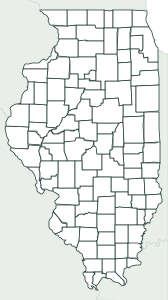
Frequently asked questions
How many counties does Missouri have?
114 counties and St. Louis City, 115 in all. That’s the 5th most of any state.
What is the largest county in Missouri?
Texas, with 1,177 sq mi of land. The smallest is St. Louis (city), with 62 sq mi.
What is the most populous county in Missouri?
St. Louis County, with an estimated 990,911 people in 2025, or 16% of the state.
What county is Jefferson City in?
The state capital, Jefferson City, is in Cole County, home to 99% of its residents; the city also reaches into Callaway County.
Can I use it in class?
Yes, it’s free. Print it, copy it and hand it out as many times as you like. If you post it on a blog or a class website, credit “Mapsfera · data US Census Bureau”.
How do I print it on US Letter paper?
Choose Letter in “Paper size” and click “Download PDF”. In the print window, pick Letter paper and 100% scale (“Actual size”). For a bigger map, choose Tabloid (11 × 17 in) or A3.
What order are the numbers in?
Alphabetical, from 1 to the last one. That makes the key easy to follow when you grade, and it’s the same key the worksheet’s answer page uses.
Sources
- Boundaries: U.S. Census Bureau, Cartographic Boundary Files 2025, counties at 1:500,000 (public domain)
- Land and water area: U.S. Census Bureau (TIGER/Line and 2025 Gazetteer); population: Vintage 2025 estimates (July 1, 2025)
- State capital: Natural Earth, Populated Places (public domain); which counties it spans, Census places
- Neighbors, coastline and borders: calculated from those boundaries (and checked against the Census county adjacency file)