Blank map of Indiana by county
All 92 counties of Indiana, ready to print on Letter, Tabloid, A4 or A3, or to download as PNG and SVG. Free, no sign-up.
Preview · A4 portrait · Blank
Set up your sheet
Version
Paper size
Orientation
Title on the sheet
The PDF comes out at actual size, with margins so nothing gets cut off. In the print window, choose “Save as PDF”. Letter and Tabloid are US paper sizes; A4 and A3, the rest of the world’s.
License
Free for class and personal use
Print it, copy it and hand it out. If you publish it, credit it like this. For other uses, get in touch.
Mapsfera · data US Census Bureau
Indiana on the map
Indiana has 92 counties, the 12th most of any state. The largest is Allen, with 657 sq mi of land, and the smallest is Ohio, with 86 sq mi: Allen is about 8 times bigger.
The state capital, Indianapolis, is in Marion County. The capital version marks it on the map.
Marion County is the most populous, with 992,196 people in 2025, or 14% of the state. The least populous is also Ohio, with 5,994. Since 2020, Boone has grown the fastest (+14.0%) and Miami has lost the most (−4.1%).
What each county borders
Grant borders the most counties in the state: 9 (Blackford, Delaware, Howard, Huntington, Madison, Miami, Tipton, Wabash, and Wells).
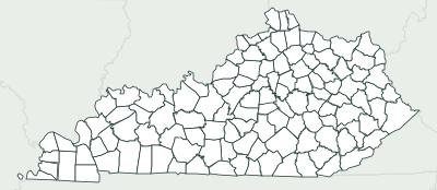
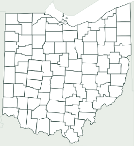
35 counties touch another state. 13 border Kentucky: Clark, Crawford, Dearborn, Floyd, Harrison, Jefferson, Ohio, Perry and 5 more. 10 border Ohio: Adams, Allen, Dearborn, DeKalb, Franklin, Jay, Randolph, Steuben and 2 more. 10 border Illinois: Benton, Gibson, Knox, Lake, Newton, Posey, Sullivan, Vermillion and 2 more. 5 border Michigan: Elkhart, LaGrange, LaPorte, St. Joseph, and Steuben.
3 counties are on the shore of the Great Lakes: Lake, LaPorte, and Porter. 56 counties are fully inland, with no coast and no border with another state or country.
Number key
Numbers follow alphabetical order, from 1 (Adams) to 92 (Whitley). Ohio and Vermillion are too small for a number on Letter or A4 but keep their number in the table; Tabloid and A3 fit more. Area is land area, without lakes or sea, and population is the Census estimate for July 1, 2025; “Borders” counts neighboring counties in the same state.
Show the whole table (92 rows)
| No. | County | Land area | Population (2025) | Borders |
|---|---|---|---|---|
| 1 | Adams | 339 sq mi | 36,650 | 3 |
| 2 | Allen | 657 sq mi | 402,329 | 6 |
| 3 | Bartholomew | 407 sq mi | 85,729 | 6 |
| 4 | Benton | 406 sq mi | 8,883 | 5 |
| 5 | Blackford | 165 sq mi | 11,730 | 4 |
| 6 | Boone | 423 sq mi | 80,689 | 5 |
| 7 | Brown | 312 sq mi | 15,777 | 5 |
| 8 | Carroll | 372 sq mi | 20,655 | 5 |
| 9 | Cass | 412 sq mi | 37,836 | 6 |
| 10 | Clark | 372 sq mi | 130,451 | 4 |
| 11 | Clay | 358 sq mi | 26,410 | 6 |
| 12 | Clinton | 405 sq mi | 33,322 | 7 |
| 13 | Crawford | 306 sq mi | 10,509 | 5 |
| 14 | Daviess | 429 sq mi | 34,209 | 5 |
| 15 | Dearborn | 305 sq mi | 51,609 | 3 |
| 16 | Decatur | 373 sq mi | 26,576 | 6 |
| 17 | DeKalb | 363 sq mi | 44,535 | 3 |
| 18 | Delaware | 392 sq mi | 113,106 | 6 |
| 19 | Dubois | 427 sq mi | 44,016 | 8 |
| 20 | Elkhart | 463 sq mi | 208,774 | 5 |
| 21 | Fayette | 215 sq mi | 23,533 | 5 |
| 22 | Floyd | 148 sq mi | 82,153 | 3 |
| 23 | Fountain | 396 sq mi | 17,013 | 5 |
| 24 | Franklin | 384 sq mi | 23,286 | 6 |
| 25 | Fulton | 368 sq mi | 20,091 | 6 |
| 26 | Gibson | 487 sq mi | 33,091 | 5 |
| 27 | Grant | 414 sq mi | 66,524 | 9 |
| 28 | Greene | 542 sq mi | 31,165 | 8 |
| 29 | Hamilton | 394 sq mi | 387,036 | 6 |
| 30 | Hancock | 306 sq mi | 90,969 | 6 |
| 31 | Harrison | 484 sq mi | 40,437 | 3 |
| 32 | Hendricks | 407 sq mi | 193,510 | 5 |
| 33 | Henry | 392 sq mi | 49,137 | 7 |
| 34 | Howard | 293 sq mi | 83,904 | 6 |
| 35 | Huntington | 383 sq mi | 37,224 | 5 |
| 36 | Jackson | 510 sq mi | 47,370 | 7 |
| 37 | Jasper | 560 sq mi | 33,894 | 7 |
| 38 | Jay | 384 sq mi | 20,118 | 5 |
| 39 | Jefferson | 361 sq mi | 33,279 | 5 |
| 40 | Jennings | 377 sq mi | 27,622 | 6 |
| 41 | Johnson | 320 sq mi | 174,262 | 5 |
| 42 | Knox | 516 sq mi | 35,652 | 5 |
| 43 | Kosciusko | 531 sq mi | 80,892 | 6 |
| 44 | LaGrange | 380 sq mi | 41,305 | 3 |
| 45 | Lake | 499 sq mi | 504,612 | 3 |
| 46 | LaPorte | 598 sq mi | 111,294 | 3 |
| 47 | Lawrence | 449 sq mi | 45,568 | 6 |
| 48 | Madison | 452 sq mi | 135,088 | 6 |
| 49 | Marion | 396 sq mi | 992,196 | 7 |
| 50 | Marshall | 444 sq mi | 46,599 | 5 |
| 51 | Martin | 336 sq mi | 9,856 | 5 |
| 52 | Miami | 374 sq mi | 34,487 | 5 |
| 53 | Monroe | 395 sq mi | 143,345 | 6 |
| 54 | Montgomery | 505 sq mi | 38,954 | 7 |
| 55 | Morgan | 404 sq mi | 74,967 | 7 |
| 56 | Newton | 402 sq mi | 14,188 | 3 |
| 57 | Noble | 411 sq mi | 47,937 | 6 |
| 58 | Ohio | 86 sq mi | 5,994 | 3 |
| 59 | Orange | 398 sq mi | 19,834 | 5 |
| 60 | Owen | 385 sq mi | 21,886 | 5 |
| 61 | Parke | 445 sq mi | 16,642 | 6 |
| 62 | Perry | 382 sq mi | 19,389 | 3 |
| 63 | Pike | 334 sq mi | 12,003 | 5 |
| 64 | Porter | 418 sq mi | 176,049 | 3 |
| 65 | Posey | 409 sq mi | 24,988 | 2 |
| 66 | Pulaski | 434 sq mi | 12,463 | 5 |
| 67 | Putnam | 481 sq mi | 37,876 | 6 |
| 68 | Randolph | 452 sq mi | 24,438 | 4 |
| 69 | Ripley | 446 sq mi | 29,434 | 7 |
| 70 | Rush | 408 sq mi | 16,767 | 6 |
| 71 | Scott | 190 sq mi | 25,053 | 5 |
| 72 | Shelby | 411 sq mi | 45,882 | 6 |
| 73 | Spencer | 397 sq mi | 20,061 | 3 |
| 74 | St. Joseph | 458 sq mi | 272,861 | 4 |
| 75 | Starke | 309 sq mi | 23,425 | 5 |
| 76 | Steuben | 309 sq mi | 34,799 | 2 |
| 77 | Sullivan | 447 sq mi | 20,831 | 4 |
| 78 | Switzerland | 221 sq mi | 10,037 | 3 |
| 79 | Tippecanoe | 499 sq mi | 190,456 | 7 |
| 80 | Tipton | 261 sq mi | 15,319 | 5 |
| 81 | Union | 161 sq mi | 6,863 | 3 |
| 82 | Vanderburgh | 233 sq mi | 181,995 | 3 |
| 83 | Vermillion | 257 sq mi | 15,488 | 4 |
| 84 | Vigo | 404 sq mi | 106,512 | 4 |
| 85 | Wabash | 413 sq mi | 30,713 | 6 |
| 86 | Warren | 365 sq mi | 8,474 | 4 |
| 87 | Warrick | 385 sq mi | 66,803 | 5 |
| 88 | Washington | 514 sq mi | 28,383 | 8 |
| 89 | Wayne | 402 sq mi | 66,169 | 4 |
| 90 | Wells | 368 sq mi | 28,883 | 6 |
| 91 | White | 505 sq mi | 25,164 | 6 |
| 92 | Whitley | 336 sq mi | 35,046 | 5 |
More blank maps
All blank maps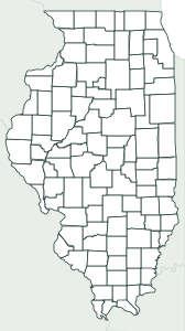
Frequently asked questions
How many counties does Indiana have?
92 counties. That’s the 12th most of any state.
What is the largest county in Indiana?
Allen, with 657 sq mi of land. The smallest is Ohio, with 86 sq mi.
What is the most populous county in Indiana?
Marion County, with an estimated 992,196 people in 2025, or 14% of the state.
What county is Indianapolis in?
The state capital, Indianapolis, is in Marion County.
Can I use it in class?
Yes, it’s free. Print it, copy it and hand it out as many times as you like. If you post it on a blog or a class website, credit “Mapsfera · data US Census Bureau”.
How do I print it on US Letter paper?
Choose Letter in “Paper size” and click “Download PDF”. In the print window, pick Letter paper and 100% scale (“Actual size”). For a bigger map, choose Tabloid (11 × 17 in) or A3.
What order are the numbers in?
Alphabetical, from 1 to the last one. That makes the key easy to follow when you grade, and it’s the same key the worksheet’s answer page uses.
Sources
- Boundaries: U.S. Census Bureau, Cartographic Boundary Files 2025, counties at 1:500,000 (public domain)
- Land and water area: U.S. Census Bureau (TIGER/Line and 2025 Gazetteer); population: Vintage 2025 estimates (July 1, 2025)
- State capital: Natural Earth, Populated Places (public domain); which counties it spans, Census places
- Neighbors, coastline and borders: calculated from those boundaries (and checked against the Census county adjacency file)