Blank map of Georgia by county
All 159 counties of Georgia, ready to print on Letter, Tabloid, A4 or A3, or to download as PNG and SVG. Free, no sign-up.
Preview · A4 portrait · Blank
Set up your sheet
Version
Paper size
Orientation
Title on the sheet
The PDF comes out at actual size, with margins so nothing gets cut off. In the print window, choose “Save as PDF”. Letter and Tabloid are US paper sizes; A4 and A3, the rest of the world’s.
License
Free for class and personal use
Print it, copy it and hand it out. If you publish it, credit it like this. For other uses, get in touch.
Mapsfera · data US Census Bureau
Georgia on the map
Georgia has 159 counties, the 2nd most of any state. The largest is Ware, with 899 sq mi of land, and the smallest is Clarke, with 119 sq mi: Ware is about 8 times bigger.
The state capital, Atlanta, is in Fulton County, home to 91% of its residents; the city also reaches into DeKalb County. The capital version marks it on the map.
Fulton County is the most populous, with 1,098,791 people in 2025, or 10% of the state. The least populous is Taliaferro, with 1,662. Since 2020, Long has grown the fastest (+33.5%) and Stewart has lost the most (−12.8%).
What each county borders
Fulton borders the most counties in the state: 10 (Carroll, Cherokee, Clayton, Cobb, Coweta, DeKalb, Douglas, Fayette, Forsyth, and Gwinnett).
46 counties touch another state. 17 border Alabama: Carroll, Chattahoochee, Chattooga, Clay, Dade, Early, Floyd, Haralson and 9 more. 13 border South Carolina: Burke, Chatham, Columbia, Effingham, Elbert, Franklin, Habersham, Hart and 5 more. 11 border Florida: Brooks, Camden, Charlton, Clinch, Decatur, Echols, Grady, Lowndes and 3 more. 6 border Tennessee: Catoosa, Dade, Fannin, Murray, Walker, and Whitfield. 4 border North Carolina: Fannin, Rabun, Towns, and Union.
6 counties are on the coast: Bryan, Camden, Chatham, Glynn, Liberty, and McIntosh. 109 counties are fully inland, with no coast and no border with another state or country.
Number key
Numbers follow alphabetical order, from 1 (Appling) to 159 (Worth). Catoosa, Clarke, Clayton, Dawson, Evans, McDuffie, Peach, Quitman, Richmond, Rockdale and 1 more are too small for a number on Letter or A4 but keep their number in the table; Tabloid and A3 fit more. Area is land area, without lakes or sea, and population is the Census estimate for July 1, 2025; “Borders” counts neighboring counties in the same state.
Show the whole table (159 rows)
| No. | County | Land area | Population (2025) | Borders |
|---|---|---|---|---|
| 1 | Appling | 508 sq mi | 19,100 | 6 |
| 2 | Atkinson | 343 sq mi | 8,454 | 5 |
| 3 | Bacon | 284 sq mi | 11,070 | 5 |
| 4 | Baker | 342 sq mi | 2,725 | 6 |
| 5 | Baldwin | 259 sq mi | 44,029 | 5 |
| 6 | Banks | 233 sq mi | 21,273 | 6 |
| 7 | Barrow | 161 sq mi | 99,773 | 4 |
| 8 | Bartow | 459 sq mi | 120,800 | 6 |
| 9 | Ben Hill | 250 sq mi | 17,099 | 5 |
| 10 | Berrien | 453 sq mi | 18,932 | 7 |
| 11 | Bibb | 249 sq mi | 157,556 | 5 |
| 12 | Bleckley | 216 sq mi | 12,866 | 5 |
| 13 | Brantley | 443 sq mi | 18,936 | 6 |
| 14 | Brooks | 493 sq mi | 16,101 | 4 |
| 15 | Bryan | 438 sq mi | 52,062 | 5 |
| 16 | Bulloch | 676 sq mi | 86,949 | 7 |
| 17 | Burke | 827 sq mi | 24,408 | 5 |
| 18 | Butts | 184 sq mi | 27,218 | 6 |
| 19 | Calhoun | 280 sq mi | 5,413 | 6 |
| 20 | Camden | 630 sq mi | 60,143 | 3 |
| 21 | Candler | 243 sq mi | 11,275 | 4 |
| 22 | Carroll | 499 sq mi | 131,036 | 6 |
| 23 | Catoosa | 162 sq mi | 69,628 | 2 |
| 24 | Charlton | 780 sq mi | 13,121 | 3 |
| 25 | Chatham | 433 sq mi | 311,855 | 2 |
| 26 | Chattahoochee | 249 sq mi | 8,465 | 4 |
| 27 | Chattooga | 313 sq mi | 25,300 | 2 |
| 28 | Cherokee | 421 sq mi | 299,273 | 6 |
| 29 | Clarke | 119 sq mi | 129,921 | 4 |
| 30 | Clay | 195 sq mi | 2,815 | 4 |
| 31 | Clayton | 142 sq mi | 297,471 | 5 |
| 32 | Clinch | 815 sq mi | 6,847 | 4 |
| 33 | Cobb | 340 sq mi | 793,345 | 5 |
| 34 | Coffee | 592 sq mi | 44,407 | 8 |
| 35 | Colquitt | 547 sq mi | 47,438 | 6 |
| 36 | Columbia | 290 sq mi | 169,189 | 3 |
| 37 | Cook | 228 sq mi | 18,232 | 5 |
| 38 | Coweta | 441 sq mi | 160,240 | 7 |
| 39 | Crawford | 325 sq mi | 12,206 | 5 |
| 40 | Crisp | 273 sq mi | 19,237 | 6 |
| 41 | Dade | 174 sq mi | 16,154 | 1 |
| 42 | Dawson | 211 sq mi | 35,365 | 7 |
| 43 | Decatur | 597 sq mi | 29,432 | 5 |
| 44 | DeKalb | 268 sq mi | 774,394 | 5 |
| 45 | Dodge | 496 sq mi | 19,663 | 6 |
| 46 | Dooly | 393 sq mi | 11,156 | 6 |
| 47 | Dougherty | 329 sq mi | 82,616 | 6 |
| 48 | Douglas | 200 sq mi | 154,293 | 4 |
| 49 | Early | 513 sq mi | 10,455 | 5 |
| 50 | Echols | 420 sq mi | 3,685 | 3 |
| 51 | Effingham | 479 sq mi | 74,397 | 4 |
| 52 | Elbert | 351 sq mi | 20,072 | 5 |
| 53 | Emanuel | 681 sq mi | 23,147 | 8 |
| 54 | Evans | 183 sq mi | 11,028 | 5 |
| 55 | Fannin | 387 sq mi | 26,111 | 5 |
| 56 | Fayette | 195 sq mi | 125,156 | 4 |
| 57 | Floyd | 510 sq mi | 101,378 | 5 |
| 58 | Forsyth | 225 sq mi | 282,805 | 5 |
| 59 | Franklin | 261 sq mi | 25,948 | 4 |
| 60 | Fulton | 527 sq mi | 1,098,791 | 10 |
| 61 | Gilmer | 426 sq mi | 33,894 | 5 |
| 62 | Glascock | 144 sq mi | 3,141 | 4 |
| 63 | Glynn | 420 sq mi | 87,599 | 4 |
| 64 | Gordon | 356 sq mi | 61,701 | 7 |
| 65 | Grady | 454 sq mi | 26,590 | 3 |
| 66 | Greene | 388 sq mi | 21,367 | 6 |
| 67 | Gwinnett | 431 sq mi | 1,018,099 | 7 |
| 68 | Habersham | 277 sq mi | 50,416 | 6 |
| 69 | Hall | 393 sq mi | 226,568 | 8 |
| 70 | Hancock | 471 sq mi | 8,682 | 7 |
| 71 | Haralson | 282 sq mi | 33,066 | 3 |
| 72 | Harris | 464 sq mi | 37,280 | 4 |
| 73 | Hart | 232 sq mi | 28,639 | 3 |
| 74 | Heard | 296 sq mi | 12,149 | 3 |
| 75 | Henry | 319 sq mi | 264,922 | 6 |
| 76 | Houston | 376 sq mi | 178,214 | 7 |
| 77 | Irwin | 354 sq mi | 9,020 | 5 |
| 78 | Jackson | 340 sq mi | 99,265 | 5 |
| 79 | Jasper | 368 sq mi | 17,632 | 6 |
| 80 | Jeff Davis | 331 sq mi | 15,219 | 7 |
| 81 | Jefferson | 527 sq mi | 15,011 | 8 |
| 82 | Jenkins | 347 sq mi | 8,843 | 4 |
| 83 | Johnson | 303 sq mi | 9,310 | 5 |
| 84 | Jones | 394 sq mi | 29,171 | 7 |
| 85 | Lamar | 184 sq mi | 20,941 | 5 |
| 86 | Lanier | 197 sq mi | 10,623 | 5 |
| 87 | Laurens | 807 sq mi | 51,041 | 6 |
| 88 | Lee | 356 sq mi | 34,179 | 5 |
| 89 | Liberty | 516 sq mi | 70,313 | 5 |
| 90 | Lincoln | 210 sq mi | 8,112 | 4 |
| 91 | Long | 400 sq mi | 21,557 | 4 |
| 92 | Lowndes | 497 sq mi | 122,867 | 5 |
| 93 | Lumpkin | 281 sq mi | 36,178 | 5 |
| 94 | Macon | 401 sq mi | 11,756 | 6 |
| 95 | Madison | 282 sq mi | 32,919 | 7 |
| 96 | Marion | 366 sq mi | 7,676 | 7 |
| 97 | McDuffie | 257 sq mi | 21,640 | 6 |
| 98 | McIntosh | 431 sq mi | 11,989 | 4 |
| 99 | Meriwether | 501 sq mi | 21,516 | 7 |
| 100 | Miller | 282 sq mi | 5,812 | 4 |
| 101 | Mitchell | 512 sq mi | 20,467 | 7 |
| 102 | Monroe | 396 sq mi | 32,023 | 7 |
| 103 | Montgomery | 241 sq mi | 8,635 | 4 |
| 104 | Morgan | 347 sq mi | 22,095 | 6 |
| 105 | Murray | 344 sq mi | 41,607 | 4 |
| 106 | Muscogee | 216 sq mi | 202,171 | 3 |
| 107 | Newton | 274 sq mi | 125,583 | 6 |
| 108 | Oconee | 184 sq mi | 44,893 | 6 |
| 109 | Oglethorpe | 439 sq mi | 16,415 | 7 |
| 110 | Paulding | 312 sq mi | 190,996 | 6 |
| 111 | Peach | 150 sq mi | 29,877 | 4 |
| 112 | Pickens | 232 sq mi | 37,167 | 4 |
| 113 | Pierce | 340 sq mi | 20,764 | 5 |
| 114 | Pike | 216 sq mi | 20,932 | 4 |
| 115 | Polk | 310 sq mi | 45,514 | 4 |
| 116 | Pulaski | 249 sq mi | 10,172 | 5 |
| 117 | Putnam | 345 sq mi | 23,722 | 6 |
| 118 | Quitman | 151 sq mi | 2,254 | 3 |
| 119 | Rabun | 370 sq mi | 17,764 | 2 |
| 120 | Randolph | 428 sq mi | 6,156 | 6 |
| 121 | Richmond | 324 sq mi | 206,559 | 4 |
| 122 | Rockdale | 130 sq mi | 98,416 | 5 |
| 123 | Schley | 167 sq mi | 4,593 | 4 |
| 124 | Screven | 646 sq mi | 14,408 | 4 |
| 125 | Seminole | 238 sq mi | 9,162 | 3 |
| 126 | Spalding | 196 sq mi | 70,775 | 8 |
| 127 | Stephens | 179 sq mi | 27,854 | 3 |
| 128 | Stewart | 459 sq mi | 4,631 | 5 |
| 129 | Sumter | 483 sq mi | 28,801 | 8 |
| 130 | Talbot | 391 sq mi | 5,709 | 7 |
| 131 | Taliaferro | 195 sq mi | 1,662 | 5 |
| 132 | Tattnall | 481 sq mi | 24,376 | 7 |
| 133 | Taylor | 377 sq mi | 7,818 | 7 |
| 134 | Telfair | 437 sq mi | 11,195 | 6 |
| 135 | Terrell | 336 sq mi | 8,656 | 6 |
| 136 | Thomas | 545 sq mi | 46,368 | 4 |
| 137 | Tift | 261 sq mi | 42,254 | 6 |
| 138 | Toombs | 364 sq mi | 27,545 | 5 |
| 139 | Towns | 167 sq mi | 13,285 | 4 |
| 140 | Treutlen | 199 sq mi | 6,466 | 4 |
| 141 | Troup | 414 sq mi | 72,844 | 4 |
| 142 | Turner | 285 sq mi | 8,983 | 6 |
| 143 | Twiggs | 359 sq mi | 7,597 | 5 |
| 144 | Union | 324 sq mi | 27,859 | 4 |
| 145 | Upson | 323 sq mi | 28,500 | 7 |
| 146 | Walker | 446 sq mi | 70,250 | 6 |
| 147 | Walton | 327 sq mi | 112,696 | 6 |
| 148 | Ware | 899 sq mi | 36,906 | 7 |
| 149 | Warren | 284 sq mi | 5,269 | 6 |
| 150 | Washington | 679 sq mi | 19,453 | 6 |
| 151 | Wayne | 642 sq mi | 32,481 | 7 |
| 152 | Webster | 210 sq mi | 2,369 | 5 |
| 153 | Wheeler | 295 sq mi | 7,570 | 6 |
| 154 | White | 241 sq mi | 29,802 | 5 |
| 155 | Whitfield | 290 sq mi | 106,212 | 4 |
| 156 | Wilcox | 378 sq mi | 8,797 | 7 |
| 157 | Wilkes | 470 sq mi | 9,540 | 6 |
| 158 | Wilkinson | 449 sq mi | 8,650 | 6 |
| 159 | Worth | 571 sq mi | 20,059 | 7 |
More blank maps
All blank maps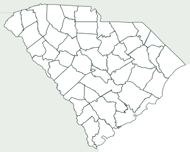
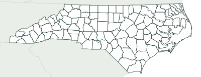
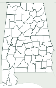
Frequently asked questions
How many counties does Georgia have?
159 counties. That’s the 2nd most of any state.
What is the largest county in Georgia?
Ware, with 899 sq mi of land. The smallest is Clarke, with 119 sq mi.
What is the most populous county in Georgia?
Fulton County, with an estimated 1,098,791 people in 2025, or 10% of the state.
What county is Atlanta in?
The state capital, Atlanta, is in Fulton County, home to 91% of its residents; the city also reaches into DeKalb County.
Can I use it in class?
Yes, it’s free. Print it, copy it and hand it out as many times as you like. If you post it on a blog or a class website, credit “Mapsfera · data US Census Bureau”.
How do I print it on US Letter paper?
Choose Letter in “Paper size” and click “Download PDF”. In the print window, pick Letter paper and 100% scale (“Actual size”). For a bigger map, choose Tabloid (11 × 17 in) or A3.
What order are the numbers in?
Alphabetical, from 1 to the last one. That makes the key easy to follow when you grade, and it’s the same key the worksheet’s answer page uses.
Sources
- Boundaries: U.S. Census Bureau, Cartographic Boundary Files 2025, counties at 1:500,000 (public domain)
- Land and water area: U.S. Census Bureau (TIGER/Line and 2025 Gazetteer); population: Vintage 2025 estimates (July 1, 2025)
- State capital: Natural Earth, Populated Places (public domain); which counties it spans, Census places
- Neighbors, coastline and borders: calculated from those boundaries (and checked against the Census county adjacency file)