Blank map of Virginia’s counties and cities
All 133 counties and cities of Virginia, ready to print on Letter, Tabloid, A4 or A3, or to download as PNG and SVG. Free, no sign-up.
Preview · A4 landscape · Blank
Set up your sheet
Version
Paper size
Orientation
Title on the sheet
The PDF comes out at actual size, with margins so nothing gets cut off. In the print window, choose “Save as PDF”. Letter and Tabloid are US paper sizes; A4 and A3, the rest of the world’s.
License
Free for class and personal use
Print it, copy it and hand it out. If you publish it, credit it like this. For other uses, get in touch.
Mapsfera · data US Census Bureau
Virginia on the map
Virginia has 95 counties and 38 independent cities, the 3rd most of any state. The largest is Pittsylvania, with 969 sq mi of land, and the smallest is Falls Church, with 2 sq mi: Pittsylvania is about 474 times bigger.
The state capital, Richmond, is an independent city that belongs to no county. The capital version marks it on the map.
Fairfax County is the most populous, with 1,167,873 people in 2025, or 13% of the state. The least populous is Highland, with 2,318. Since 2020, New Kent has grown the fastest (+22.1%) and Buchanan has lost the most (−9.1%).
Virginia has 38 independent cities that belong to no county. The Census treats them as county equivalents, and so does this map. Many are tiny at this scale (Falls Church, Manassas Park, Norton…) and get a circle so you can see them.
What each county or city borders
Chesterfield borders the most counties and cities in the state: 10 (Amelia, Charles City, Dinwiddie, Henrico, Powhatan, Prince George, Colonial Heights, Hopewell, Petersburg, and Richmond (city)).
38 counties and cities touch another state. 14 border West Virginia: Alleghany, Augusta, Bath, Bland, Buchanan, Clarke, Craig, Frederick and 6 more. 14 border North Carolina: Brunswick, Carroll, Chesapeake, Danville, Grayson, Greensville, Halifax, Henry and 6 more. 5 border Tennessee: Bristol, Grayson, Lee, Scott, and Washington. 4 border Maryland: Accomack, Alexandria, Fairfax, and Loudoun. 4 border Kentucky: Buchanan, Dickenson, Lee, and Wise. 2 border Washington, D.C.: Alexandria and Arlington.
26 counties and cities are on the coast. 73 counties and cities are fully inland, with no coast and no border with another state or country.
Number key
Numbers follow alphabetical order, from 1 (Accomack) to 133 (York). Alexandria, Amelia, Appomattox, Arlington, Bristol, Brunswick, Buena Vista, Caroline, Charles City, Charlottesville and 53 more are too small for a number on Letter or A4 but keep their number in the table; Tabloid and A3 fit more. Area is land area, without lakes or sea, and population is the Census estimate for July 1, 2025; “Borders” counts neighboring counties and cities in the same state.
Show the whole table (133 rows)
| No. | County or city | Land area | Population (2025) | Borders |
|---|---|---|---|---|
| 1 | Accomack | 449 sq mi | 33,859 | 1 |
| 2 | Albemarle | 720 sq mi | 118,356 | 9 |
| 3 | Alexandria | 15 sq mi | 160,662 | 2 |
| 4 | Alleghany | 447 sq mi | 14,546 | 5 |
| 5 | Amelia | 355 sq mi | 13,632 | 6 |
| 6 | Amherst | 474 sq mi | 31,962 | 6 |
| 7 | Appomattox | 334 sq mi | 17,172 | 6 |
| 8 | Arlington | 26 sq mi | 243,931 | 3 |
| 9 | Augusta | 967 sq mi | 78,940 | 8 |
| 10 | Bath | 529 sq mi | 4,076 | 4 |
| 11 | Bedford | 760 sq mi | 83,059 | 8 |
| 12 | Bland | 358 sq mi | 6,151 | 5 |
| 13 | Botetourt | 541 sq mi | 34,144 | 5 |
| 14 | Bristol | 13 sq mi | 16,418 | 1 |
| 15 | Brunswick | 566 sq mi | 15,727 | 5 |
| 16 | Buchanan | 503 sq mi | 18,492 | 3 |
| 17 | Buckingham | 580 sq mi | 17,137 | 6 |
| 18 | Buena Vista | 6 sq mi | 6,672 | 1 |
| 19 | Campbell | 503 sq mi | 55,629 | 7 |
| 20 | Caroline | 527 sq mi | 34,413 | 7 |
| 21 | Carroll | 475 sq mi | 29,299 | 6 |
| 22 | Charles City | 183 sq mi | 6,623 | 6 |
| 23 | Charlotte | 475 sq mi | 11,401 | 6 |
| 24 | Charlottesville | 10 sq mi | 44,388 | 1 |
| 25 | Chesapeake | 338 sq mi | 255,332 | 4 |
| 26 | Chesterfield | 424 sq mi | 397,148 | 10 |
| 27 | Clarke | 176 sq mi | 15,609 | 4 |
| 28 | Colonial Heights | 8 sq mi | 18,738 | 2 |
| 29 | Covington | 5 sq mi | 5,680 | 1 |
| 30 | Craig | 328 sq mi | 4,800 | 5 |
| 31 | Culpeper | 379 sq mi | 57,666 | 6 |
| 32 | Cumberland | 297 sq mi | 10,352 | 6 |
| 33 | Danville | 43 sq mi | 41,647 | 1 |
| 34 | Dickenson | 330 sq mi | 13,236 | 3 |
| 35 | Dinwiddie | 504 sq mi | 28,896 | 8 |
| 36 | Emporia | 7 sq mi | 5,447 | 1 |
| 37 | Essex | 257 sq mi | 10,654 | 6 |
| 38 | Fairfax | 391 sq mi | 1,167,873 | 6 |
| 39 | Fairfax (city) | 6 sq mi | 26,772 | 1 |
| 40 | Falls Church | 2 sq mi | 15,159 | 2 |
| 41 | Fauquier | 648 sq mi | 76,503 | 7 |
| 42 | Floyd | 381 sq mi | 15,789 | 6 |
| 43 | Fluvanna | 287 sq mi | 28,975 | 5 |
| 44 | Franklin | 691 sq mi | 55,526 | 6 |
| 45 | Franklin (city) | 8 sq mi | 8,478 | 2 |
| 46 | Frederick | 413 sq mi | 99,955 | 4 |
| 47 | Fredericksburg | 10 sq mi | 30,393 | 2 |
| 48 | Galax | 8 sq mi | 6,670 | 2 |
| 49 | Giles | 357 sq mi | 16,564 | 4 |
| 50 | Gloucester | 218 sq mi | 40,097 | 5 |
| 51 | Goochland | 282 sq mi | 29,187 | 6 |
| 52 | Grayson | 442 sq mi | 15,230 | 5 |
| 53 | Greene | 156 sq mi | 21,958 | 5 |
| 54 | Greensville | 295 sq mi | 11,181 | 5 |
| 55 | Halifax | 818 sq mi | 33,447 | 4 |
| 56 | Hampton | 51 sq mi | 137,315 | 3 |
| 57 | Hanover | 468 sq mi | 116,423 | 7 |
| 58 | Harrisonburg | 17 sq mi | 50,839 | 1 |
| 59 | Henrico | 234 sq mi | 342,775 | 6 |
| 60 | Henry | 382 sq mi | 49,242 | 4 |
| 61 | Highland | 415 sq mi | 2,318 | 2 |
| 62 | Hopewell | 10 sq mi | 23,261 | 2 |
| 63 | Isle of Wight | 316 sq mi | 41,321 | 4 |
| 64 | James City | 142 sq mi | 83,326 | 7 |
| 65 | King and Queen | 315 sq mi | 6,743 | 7 |
| 66 | King George | 180 sq mi | 29,646 | 4 |
| 67 | King William | 274 sq mi | 19,617 | 4 |
| 68 | Lancaster | 133 sq mi | 10,995 | 2 |
| 69 | Lee | 435 sq mi | 21,642 | 2 |
| 70 | Lexington | 3 sq mi | 7,769 | 1 |
| 71 | Loudoun | 516 sq mi | 449,749 | 4 |
| 72 | Louisa | 495 sq mi | 42,924 | 6 |
| 73 | Lunenburg | 432 sq mi | 12,058 | 5 |
| 74 | Lynchburg | 49 sq mi | 81,347 | 3 |
| 75 | Madison | 321 sq mi | 14,237 | 5 |
| 76 | Manassas | 10 sq mi | 44,332 | 2 |
| 77 | Manassas Park | 3 sq mi | 16,560 | 2 |
| 78 | Martinsville | 11 sq mi | 13,849 | 1 |
| 79 | Mathews | 86 sq mi | 8,529 | 2 |
| 80 | Mecklenburg | 625 sq mi | 30,747 | 4 |
| 81 | Middlesex | 130 sq mi | 10,841 | 4 |
| 82 | Montgomery | 387 sq mi | 98,434 | 6 |
| 83 | Nelson | 471 sq mi | 14,920 | 6 |
| 84 | New Kent | 210 sq mi | 28,022 | 6 |
| 85 | Newport News | 69 sq mi | 183,230 | 3 |
| 86 | Norfolk | 53 sq mi | 231,013 | 3 |
| 87 | Northampton | 212 sq mi | 11,879 | 1 |
| 88 | Northumberland | 191 sq mi | 12,557 | 3 |
| 89 | Norton | 7 sq mi | 3,477 | 1 |
| 90 | Nottoway | 314 sq mi | 15,796 | 5 |
| 91 | Orange | 341 sq mi | 40,083 | 6 |
| 92 | Page | 310 sq mi | 23,762 | 6 |
| 93 | Patrick | 483 sq mi | 17,424 | 4 |
| 94 | Petersburg | 23 sq mi | 33,734 | 4 |
| 95 | Pittsylvania | 969 sq mi | 59,490 | 6 |
| 96 | Poquoson | 15 sq mi | 13,292 | 2 |
| 97 | Portsmouth | 33 sq mi | 96,777 | 3 |
| 98 | Powhatan | 260 sq mi | 32,591 | 4 |
| 99 | Prince Edward | 350 sq mi | 22,391 | 7 |
| 100 | Prince George | 265 sq mi | 43,936 | 7 |
| 101 | Prince William | 335 sq mi | 502,966 | 6 |
| 102 | Pulaski | 320 sq mi | 33,586 | 7 |
| 103 | Radford | 10 sq mi | 17,243 | 2 |
| 104 | Rappahannock | 266 sq mi | 7,439 | 5 |
| 105 | Richmond | 191 sq mi | 9,294 | 4 |
| 106 | Richmond (city) | 60 sq mi | 237,257 | 2 |
| 107 | Roanoke | 251 sq mi | 97,150 | 8 |
| 108 | Roanoke (city) | 43 sq mi | 99,111 | 2 |
| 109 | Rockbridge | 597 sq mi | 22,663 | 9 |
| 110 | Rockingham | 850 sq mi | 89,316 | 6 |
| 111 | Russell | 474 sq mi | 25,332 | 7 |
| 112 | Salem | 15 sq mi | 25,816 | 2 |
| 113 | Scott | 536 sq mi | 21,200 | 4 |
| 114 | Shenandoah | 508 sq mi | 45,839 | 4 |
| 115 | Smyth | 451 sq mi | 28,882 | 6 |
| 116 | Southampton | 599 sq mi | 18,110 | 6 |
| 117 | Spotsylvania | 402 sq mi | 155,388 | 7 |
| 118 | Stafford | 268 sq mi | 170,803 | 7 |
| 119 | Staunton | 20 sq mi | 26,801 | 1 |
| 120 | Suffolk | 399 sq mi | 104,699 | 4 |
| 121 | Surry | 279 sq mi | 6,603 | 5 |
| 122 | Sussex | 490 sq mi | 10,755 | 5 |
| 123 | Tazewell | 519 sq mi | 38,635 | 4 |
| 124 | Virginia Beach | 245 sq mi | 453,737 | 2 |
| 125 | Warren | 215 sq mi | 42,740 | 6 |
| 126 | Washington | 561 sq mi | 53,898 | 5 |
| 127 | Waynesboro | 15 sq mi | 23,951 | 1 |
| 128 | Westmoreland | 229 sq mi | 19,715 | 4 |
| 129 | Williamsburg | 9 sq mi | 15,861 | 2 |
| 130 | Winchester | 9 sq mi | 28,272 | 1 |
| 131 | Wise | 403 sq mi | 34,824 | 5 |
| 132 | Wythe | 462 sq mi | 27,983 | 5 |
| 133 | York | 105 sq mi | 71,374 | 6 |
More blank maps
All blank maps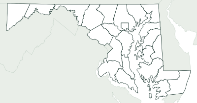
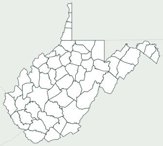
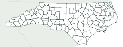
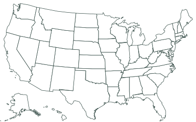
Frequently asked questions
How many counties and cities does Virginia have?
95 counties and 38 independent cities, 133 in all. That’s the 3rd most of any state.
What is the largest county or city in Virginia?
Pittsylvania, with 969 sq mi of land. The smallest is Falls Church, with 2 sq mi.
What is the most populous county or city in Virginia?
Fairfax County, with an estimated 1,167,873 people in 2025, or 13% of the state.
What county or city is Richmond in?
The state capital, Richmond, is an independent city that belongs to no county.
What is an independent city in Virginia?
A city that is not part of any county and does a county’s job itself, with its own government, courts and schools. Virginia has 38, from Virginia Beach, the most populous, to Norton, the smallest. A few share their name with a nearby county (Fairfax, Franklin, Richmond, Roanoke): on the map they are labeled “(city)”.
Can I use it in class?
Yes, it’s free. Print it, copy it and hand it out as many times as you like. If you post it on a blog or a class website, credit “Mapsfera · data US Census Bureau”.
How do I print it on US Letter paper?
Choose Letter in “Paper size” and click “Download PDF”. In the print window, pick Letter paper and 100% scale (“Actual size”). For a bigger map, choose Tabloid (11 × 17 in) or A3.
What order are the numbers in?
Alphabetical, from 1 to the last one. That makes the key easy to follow when you grade, and it’s the same key the worksheet’s answer page uses.
Sources
- Boundaries: U.S. Census Bureau, Cartographic Boundary Files 2025, counties at 1:500,000 (public domain)
- Land and water area: U.S. Census Bureau (TIGER/Line and 2025 Gazetteer); population: Vintage 2025 estimates (July 1, 2025)
- State capital: Natural Earth, Populated Places (public domain); which counties it spans, Census places
- Neighbors, coastline and borders: calculated from those boundaries (and checked against the Census county adjacency file)